Mt.Yatsugatake (Akadake)
Data
Max artitude: 2899m
Min artitude: 1480m
Course distance: 6.5km+11.1km
Course time: 3h35m+8h30m
Overview of the mountain
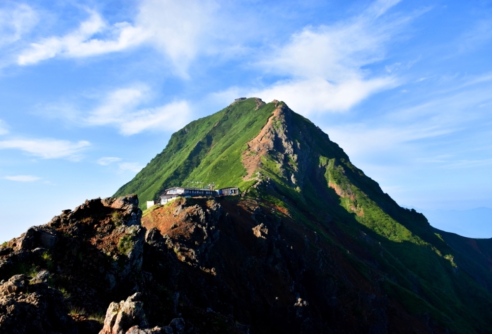
Mt.Yatsugatake is one of the most famous mountains in Japan. The name "Yatsugatake" literaly means "eight mountains" but it is actually a cluster of more than eight peaks. The highest peak is Aka-dake(2899m), the name of which means "a red mountain".
This mountain is also known as the highland resort area. There are many hotsprings, peaceful cottages and is even an shopping-mall around the foot of this mountain.
There are varieties of trailcourses in Yatsugatake, which are not only tough rocky ones but relatively easy even for children to walk.
Yatsugatake is divided into two areas by mountain's flora, north and south. Northern Yatsugatake is covered with deep forests and has gently slopes easy to walk. On the other hand, Southern Yatsugatake has steep rocky trails and its altitude is higher than that of north area. So if you are to visit south area, adequate gears are required.
My visiting report:
[DAY1] 6-Aug-2015, fair
[DAY2] 7-Aug-2015, fair
[DAY1]
At 10:25AM, starting from Yatsugatake-sanso hut near Minotoguchi-busstop.
At 11:20AM, after hour-long forest walk, reached to Minoto-sanso hut in front of the trailhead.
At 14:00PM, at the end of the trailcourse along a clear stream, we can see a hut "Akadake-Kosen".
[DAY2]
At 5:00AM, leaving Akadake-Kosen in dusky sunlight.
At 5:30AM, after half-hour-forest-trekking, arriving at a hut "Gyojya-goya".
At 7:05AM, taking a rest at Jizo-no-kashira peak.
At 8:00AM, going through a fragile red rocky trailcourse, we finally reached to the summit of Akadake!
At 9:40AM, going down on a slippy graveled road and through Nakadake peak.
At 10:55AM, arriving at Gyojya-goya again and having a curry and rice for early-lunch.
At 13:30PM, back to Yatsugatake-sanso, taking a onsen and waiting for a bus.
How to access from Tokyo station
Train and Bus
Tokyo stationChuo-line (rapid or local)
Shinjuku station
Chuo-line (Ltd.Exp."Azusa")
Chino station
Alpiko-Kotsu-bus
Minotoguchi-busstop
[Overall approximately 3h20m]
Cars
Tokyo stationShuto expwy, Chuo expwy
Kobuchizawa Interchange
Mainly route484
Minotoguchi-busstop
[Overall approximately 2h50m]
Equipments you'd better prepare
Must-equipped
A bottle of water (at least 1000ml per day)Foods (at least two rice balls and four energy gels per day)
Trekking shoes
Rain wears
Preferablly-equipped
A hatTrekking poles
+more activities
Yatsugatake Resort Outlets (Shopping Complex)
Kiyosato town (Plateau resort area)
Shirakabako lake (Resort lake)